An ink quill and parchment. Photo credit: Mushki Brichta.
With two junior papers under my belt now, I’ve been taking some time to reflect on my writing strategies as I gear up to tackle my senior thesis next year. I’ve accumulated a list of what I think I would have benefited most from hearing, and I intend to take these lessons with me for my next year of work.
Thinking in Cannon Green (probably about a JP!). Photo Credit: Matt Raspanti.
It’s that time of year: I am writing a Junior Proposal as a molecular biology major. There are a few things I found about this experience that have humbled me very deeply. I obviously did not expect a cakewalk. I think it’s a good time for me to let juniors know; it’s not necessarily a difficult experience, but it’s strangely timed. The deadlines (at least for my major) are right in the middle of a somewhat hectic time between exams and the long stretch of spring semester post-spring break. Many of my peers (including myself) have been doing experiments for a while now, and working on the paper feels like coming up for air from a very deep lair at the bottom of the ocean. It can be very disorienting. The issue is that it requires a different way of thinking than when you’re in the midst of experimentation.
Historiographies are historical analyses of the historical scholarship written about a given subject. Rather than just identifying gaps in a scholarly conversation, historiographies analyze how that historical literature has been produced and how it has changed over time. Writing a historiography gives you the chance to make a historical argument about how the knowledge in your field has developed and evolved. However, approaching a whole new field of literature as an undergraduate researcher can be overwhelming. Here are some strategies I’ve used to parse historical literature and write historiographies for my independent work.
I start my historiographies in Firestone looking for a wide range of literature.Photo credit: Denise Applewhite.
Le Penseur (The Thinker) Statue, by Auguste Rodin (1904)
As I wrapped up the first of my two independent junior research papers and began brainstorming for the second (and much larger) one, I hit a familiar wall: too much possibility, with no clear direction.
This next paper is supposed to be around 30 pages. The topic is broad. My notes are abundant and scattered. Every passage and source I consider seems to open a new direction I could take. In theory, this is a researcher’s dream – I have abundant evidence, rich material, and intellectual freedom. In practice though, it can feel paralyzing. What is even relevant? How do I start this? What am I actually trying to say?
My high school English teacher gave me the most useful writing advice I’ve ever heard: “With focus comes depth, and with depth comes complexity.”
Entrance to Aaron Burr Hall, home to the anthropology department and my JP adviser. Photo credit: AccessAbleUSA
Whether it’s long hours alone in a lab or late nights in Firestone, research can feel like a uniquely isolating experience. The process of compiling existing knowledge and producing new knowledge invites us to dive deep into ongoing conversations that exist within our fields. These deep dives into the procedures, frameworks, and models that define research projects require a degree of focus that can narrow our view. One of the few moments in any research journey that disrupts this individual flow is the feedback process. That moment, when we are reminded that research is explicitly collaborative, is always critical and often dreaded. Having received my fair share of feedback over the years, I’ve learned just how important each step of the feedback process is. This goes beyond just receiving feedback, but instead really considering the importance of preparing for feedback too.
New South, where many first-year writing seminars and sophomore research seminars take place.
First-year writing seminars are a rite of passage for all Princeton students, introducing you to the research and writing skills you need to craft an independent research paper. But what comes next? For many undergraduates, sophomore year is a year-long pause before you actually get to apply those independent research skills in your JP. The Princeton Writing Program’s sophomore research seminars offer an alternative.
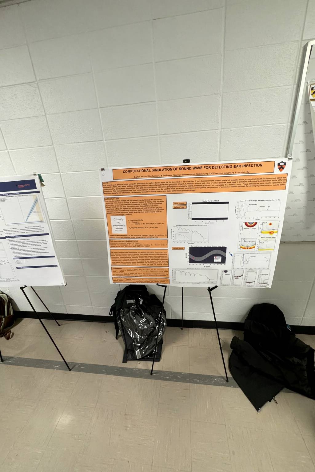
Last semester, as a sophomore in the Electrical and Computer Engineering Department, I completed my first independent research project as part of the Sophomore Independent Work (ECE 298) with Swan Labs, a lab that works on next-generation wireless systems by combining electromagnetics, signal processing, and system-level design to build fast, intelligent, secure, and adaptable wireless technologies. While I had done research in high school before, this was my first time engaging in research within a truly structured academic setting. The experience felt fundamentally different from anything I had done previously, and it reshaped how I understand what research really means.
A student working in Firestone Library. Photo credit: Denise Applewhite, Princeton Department of Communications
If someone asked me to describe my experiences with research in a word, I’d probably end up at a loss. My research experiences have been exciting, tiring, and fulfilling all at once. Research is endlessly multifaceted, with each experience being unique. Still, a few constants remain, and deadlines are certainly one of them. No matter the methods, no matter the discipline, every project eventually comes to an end. As that moment creeps closer, it often feels more and more inconveniently insurmountable.
Despite this, deadlines are important. They not only help with the goal-setting process, but also force us to abandon the appeal of endless revisions in the pursuit of perfection. Deadlines ensure that, at some point, there will be a final product. Meeting those deadlines, however, is a different story and one that can present real challenges.
I’ll be checking out books from Firestone Library before heading home for winter break.
As another semester draws to a close and winter break looms, now is the perfect time to make a plan for independent work over break. The flexibility of break can give you the freedom to work on your own schedule, but it can also be challenging to keep making progress without the external structure of the semester. Here are a few things that I’m doing before leaving campus to help set me up for thesis writing over the break:
Roman copy of a Greek bronze bust of Aristotle by Lysippos (c. 330 BC).
Aristotle’s Metaphysics begin with an oft-quoted adage: πάντες ἄνθρωποι τοῦ εἰδέναι ὀρέγονται φύσει (Aristotle, Metaphysics A.1 980a). “All humans, by their nature, strive to understand.”
With some spare time over fall break, I decided to brush up on my Greek philosophy. My upcoming junior independent work will focus on Lucretius’ philosophical poem De Rerum Natura, and he engages with so many ideas from ancient Greek thinkers – Epicurus, Democritus, Plato, and Aristotle, to name a few – I thought it prudent to be familiar with them. Given that the very purpose of their works is to explain their ideas, I didn’t expect to run into serious trouble as I began reading them. Instead, as I started making my way through Aristotle’s Metaphysics and Plato’s Timaeus, I found myself entangled with ideas of identity, causation, and substance. My overwhelming reaction was… “wait, what?”